15.01.2026
Estimated Reading Time: 7 minutes
Key Takeaways
- Geospatial surveying provides essential baseline data for informed decision-making throughout the lifecycle of infrastructure projects.
- Environmental due diligence through geospatial methods identifies potential risks and ensures regulatory compliance.
- Modern geospatial technologies, including LiDAR and UAV platforms, deliver centimetre-level accuracy for infrastructure applications.
- Integration of geospatial data with Building Information Modelling creates intelligent digital representations for project visualisation and clash detection.
- Real-time monitoring capabilities enable proactive risk management during construction phases.
- Sustainable infrastructure development relies on comprehensive geospatial data for environmental assessment and resource optimisation.
What Is Geospatial Surveying and Why Does It Matter for Infrastructure?
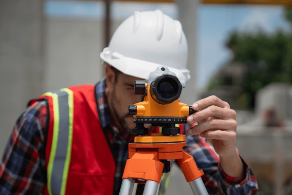
Infrastructure development requires a sophisticated integration of spatial technologies and environmental assessment methodologies. Geospatial surveying represents a comprehensive discipline that combines multiple technological platforms to capture, analyse and visualise spatial data for infrastructure applications.
Core Technological Components
- Satellite positioning systems for precise location data.
- Laser scanning technology for detailed surface mapping.
- Photogrammetry for visual documentation.
- Geographic Information Systems (GIS) for spatial analysis.
This technological convergence enables the creation of comprehensive digital representations of physical environments. For infrastructure projects across the UK, including rail networks, energy facilities and logistics operations, these spatial datasets form the foundation for project planning and execution.
The evolution from conventional surveying methods to technology-enabled approaches has transformed data collection capabilities.
Digital capture technologies rapidly gather extensive datasets, creating detailed three-dimensional models that serve as foundations for Building Information Modelling and digital twin development.
How Does Environmental Due Diligence Support Infrastructure Projects?
Environmental due diligence is a critical component of infrastructure development, encompassing the systematic assessment of environmental conditions, contamination potential, ecological sensitivities, and regulatory constraints.
Assessment Methodology
| Assessment Type | Purpose | Key Outputs |
| Environmental baseline studies | Habitat identification | Species surveys, ecological mapping |
| Flood risk evaluation | Terrain analysis for drainage | Flood zone maps, mitigation strategies |
| Soil condition assessment | Foundation design support | Geotechnical reports, contamination analysis |
| Vegetation pattern documentation | Ecological impact assessment | Habitat surveys, biodiversity reports |
Modern geospatial techniques enable comprehensive environmental assessment through multispectral imaging and remote sensing technologies. These tools facilitate monitoring of seasonal variations, wildlife movement patterns and cumulative development impacts, ensuring infrastructure projects achieve regulatory compliance and ecological compatibility.
Integrating environmental data early in project lifecycles allows developers to anticipate challenges, allocate resources for mitigation measures and design infrastructure that minimises ecological disruption.
What Technologies Are Used in Modern Geospatial Data Acquisition?
Contemporary geospatial surveying leverages advanced technological platforms that transform infrastructure development capabilities. Each technology offers specific advantages for different surveying applications.
Geospatial Technology Comparison
| Technology | Accuracy Level | Best Applications | Key Advantages |
| LiDAR (Light Detection and Ranging) | Centimetre-level | Railway corridors, highway alignment, terrain mapping | Penetrates vegetation canopy |
| UAV (Unmanned Aerial Vehicle) | Sub-decimetre | Construction monitoring, infrastructure inspection | Rapid data capture, minimal disruption |
| GNSS (Global Navigation Satellite System) | Millimetre-level with RTK | Construction setout, structural monitoring | Real-time positioning |
| Ground Penetrating Radar | Variable by soil type | Underground utilities, subsurface investigation | Non-destructive detection |
Light Detection and Ranging (LiDAR) Technology: LiDAR systems penetrate vegetation canopies to reveal ground topography with centimetre-level precision. This capability proves essential for railway corridor assessments and highway alignment studies where accurate terrain mapping determines project feasibility.
Uncrewed Aerial Vehicle (UAV) Platforms: UAV systems equipped with high-resolution sensors enable rapid data capture across challenging terrains. These platforms facilitate progress monitoring and infrastructure inspection without disrupting operations.
Global Navigation Satellite System (GNSS) Applications: Real-time kinematic positioning achieves millimetre-level precision for construction setout, structural movement monitoring and design verification. This accuracy ensures built assets align precisely with design specifications.
The convergence of these technologies with computational analysis enables automated feature extraction, change detection and predictive modelling. Infrastructure developers process extensive datasets efficiently, identifying patterns and optimising project outcomes through data-driven decision-making.

How Does Geospatial Surveying Integrate with Building Information Modelling?
The integration of geospatial surveying with Building Information Modelling represents a fundamental shift in infrastructure project delivery methodologies. Incorporating accurate geospatial data into BIM workflows creates intelligent three-dimensional models that serve as authoritative project references.
Technical Benefits of Integration
- Clash detection analysis before construction commencement.
- Accurate quantity extraction for procurement planning.
- Construction sequencing simulation for logistics optimisation.
- Stakeholder collaboration through shared digital platforms.
Complex infrastructure projects involving multiple disciplines benefit from this integrated approach, reducing miscommunication and preventing rework through coordinated digital workflows.
Digital twin creation relies on continuous geospatial data integration, enabling real-time monitoring, predictive maintenance planning and operational scenario testing. These capabilities extend value delivery beyond construction completion into operational phases.
What Are the Sector-Specific Applications of Geospatial Surveying?
Different infrastructure sectors implement geospatial surveying technologies in line with specific operational requirements and regulatory frameworks.
Rail Infrastructure Applications
Mobile laser-scanning systems mounted on rail vehicles capture corridor data at operational speeds, maintaining survey accuracy essential to safety-critical applications. Track alignment verification and overhead line equipment positioning depend on this spatial precision.
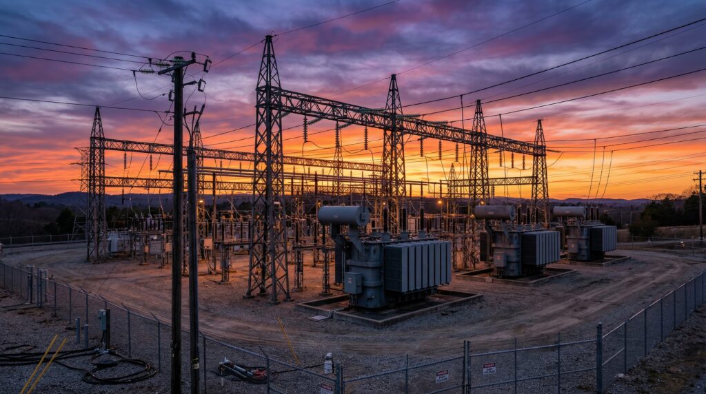
Energy Infrastructure Development
Renewable energy projects use geospatial analysis for site selection and design optimisation. Wind resource assessment, visual impact evaluation and access route planning rely on comprehensive spatial datasets. Solar installations employ terrain analysis and shading studies derived from geospatial surveys to optimise energy generation.
Water and Utilities Management
Underground infrastructure mapping through ground-penetrating radar and electromagnetic detection methods supports asset management strategies. This subsurface intelligence prevents service strikes during construction and enables strategic network planning.

How Does Geospatial Surveying Support Risk Management?
Comprehensive risk management in infrastructure development requires a detailed understanding of site conditions through systematic spatial analysis. Geospatial surveying provides the intelligence necessary for informed risk assessment and mitigation planning.
Environmental due diligence identifies protected species habitats and archaeological sensitivities that could impact project delivery if discovered during construction. Proactive identification enables developers to incorporate mitigation costs into project budgets and programmes.
Continuous geospatial monitoring throughout construction phases detects ground movements, structural deformations and environmental changes.
This surveillance capability supports adaptive management strategies that maintain project momentum. Civil and structural engineering teams use this data to ensure structural integrity throughout project lifecycles.
How Does Geospatial Surveying Enable Sustainable Infrastructure Development?
Infrastructure development increasingly incorporates sustainability considerations, with geospatial surveying providing essential data for optimising environmental performance. Detailed baseline data enables designers to minimise ecological impacts and optimise resource utilisation.
Sustainability Integration Approaches
- Carbon accounting through spatial analysis of material volumes.
- Cut-and-fill optimisation using terrain data to reduce material transport.
- Local material source identification to minimise supply chain emissions.
- Construction logistics planning for emissions reduction.
The convergence of geospatial surveying with emerging technologies promises enhanced capabilities for sustainable infrastructure development. Digital twins, artificial intelligence and sensor networks create integrated systems for real-time performance optimisation and climate adaptation.
Technical Conclusions
Geospatial surveying provides the technical foundation for successful infrastructure development, delivering spatial intelligence that guides decision-making from concept through operations.
Integrating advanced surveying technologies with digital delivery methods transforms project capabilities, enabling sustainable infrastructure development that meets contemporary environmental and operational requirements.
The evolution of geospatial technologies and analytical methodologies will further enhance infrastructure development capabilities, supporting the delivery of resilient, efficient and sustainable infrastructure systems.
Contact Morson Praxis to learn more about geospatial technologies.